Sagunto marks 18 emergency meeting points in fire-risk rural areas
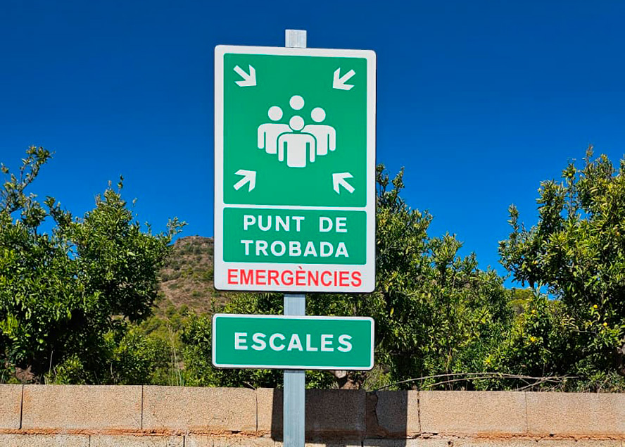
Sagunto's Agriculture Department has installed 18 "meeting point" signs in scattered rural housing areas (diseminados) near forest zones, as part of the municipal wildfire prevention plan.
Residents in Sagunto's most outlying areas, small clusters of housing far from the town centre and right up against woodland, now have a clear reference point for emergencies: a "meeting point" sign, freshly installed by the City Council. The Agriculture Department has already fitted 18 of these signs, part of the wildfire prevention drive set out in the Municipal Action Plan (PAM), and expects to reach 20 in the coming weeks.
The signs already up cover these settlements (known locally as diseminados, scattered rural housing clusters): Escales, Pere Gil, Corona, Povitxol, Illeta y Rubio, Costa del Volant, Pla de l'Aljup y Font de Ribera, Ponera y Romeu, Bonilles y San Roque, Peruga, montañita de Piquer, Romeral y Pinada, Pla del Bou y Monte Caruana, Pla del Bou II, Partidors, Santo Espíritu, Salto del Caballo y Cabes Bort y Colejala.
Two spots are still unresolved. Tres Barrancs is on hold because the access road is being widened and cannot be touched until that work finishes. Grau Vell (a historic port-area landmark on Sagunto's coast) is waiting on permits still being processed. There is also one unusual case: one of the 18 signs already stands outside Sagunto's own boundary, in El Puig, a neighbouring municipality, because that spot turned out, with the neighbouring council's authorisation, to be the most practical location to cover the area.
Behind the initiative is Agriculture Councillor Ana María Quesada, who frames the signage as part of a broader prevention effort: the more scattered areas that have a clear reference point, the faster emergency services can act if a fire breaks out. Quesada also stresses that the department has not worked alone, but in constant coordination with the Local Police and the Fire Department, with one shared goal: getting the municipality ever better prepared for any forest-fire contingency.
The installation was carried out by people hired through an employment programme run by SEPE (Servicio Público de Empleo Estatal), the Spanish state agency, successor to the former INEM, that designs and manages employment policy across the whole country. Programmes like this let small and medium-sized town councils, such as Sagunto's, carry out maintenance and signage work without expanding staff or driving up municipal spending, which is useful for prevention work like this one that stretches across dozens of scattered points around the municipality.
Sagunto's geography explains why this signage makes sense here. The municipality combines a compact urban core, split between Sagunto and Puerto de Sagunto, with an outskirts dotted with small rural buildings, many used regularly or occasionally, that border directly onto wooded hillsides. In the event of a fire, that scattered layout makes both evacuation and locating residents harder for emergency crews; a signposted meeting point that is known in advance cuts down uncertainty in the first few minutes, which are usually the most decisive. According to municipal sources, with additional background from Wikipedia on SEPE.